A damp spring ahead favours flood risks over bushfires
Don’t get too used to the mild, sunny and dry end to winter and start to spring, because it probably won’t last long.
The Bureau of Meteorology’s long-range outlook for spring is for above-average rainfall for most of southern and eastern Australia. The extra cloud will probably make the nights less chilly but keep a lid on some daytime temperatures.

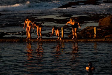
After viewing the sunrise, a group of swimmers dive into Mahon Pool at Maroubra, on the last day of winter, in Sydney. Credit:Janie Barrett
“It’s certainly a lot wetter than we had back in 2017-19, when much of eastern and southern Australia was very dry [going into spring],†Andrew Watkins, head of the bureau’s operational climate services, said.
“The main thing we’re watching is we have high rivers and full catchments.â€
For NSW, the predicted wetter-than-average conditions extend across most of the state. The damp valleys, wet soils and high stream flows mean “there’s an increased risk of floodingâ€, Dr Watkins said.
Sydney’s reservoirs remain at near-full capacity, including Warragamba Dam. As of Tuesday, the dam was 99 per cent full, about the same as a year ago, with water levels rising over the past week.
Even though the reservoirs are almost spilling, the Sydney Desalination Plant will continue to supply water until at least December 15 to ensure water quality after last year’s bushfires and floods.
The chief executive of the plant, Philip Narezzi, said they are working with the Berejiklian government on a long-term water management and security plan for Sydney, which is due to be finalised in early 2022.
Ben Domensino, a senior forecaster with Weatherzone, said rainfall for Sydney during winter was just over 200 millimetres, or about two-thirds of a typical June-August season.
“We had those long, dry spells,†he said.
The bleak COVID-19 lockdown may have made the winter seem longer and cooler than usual for many but temperatures were actual above average. Based on daytime temperatures, Sydney likely posted its fifth-warmest winter in more than 160 years of records, he said.
“You remember the extremes rather than the average,†Mr Domensino said, noting the harbour city had a 10.3-degree day on June 10, the city’s coldest day since 1984, and another chilly day in August when the mercury struggled to get above 11.
Conditions favouring the wetter-than-usual spring include relatively warm waters off north-west Western Australia and a relatively cool central Pacific that is leaning towards a La Nina event, the bureau said.
Despite the moderate lead into spring, the NSW Rural Fire Service has brought forward the start of its official bushfire season to September for most of coastal NSW, excluding Sydney.
RFS Deputy Commissioner of field operations Peter McKechnie said recent wet weather had spurred good grass and crop growth, which once dried out could provide fuel for blazes.
“Compared to the 2019-20 season, we don’t have terrible underlying drought conditions across the state,†he said. “This year, we’re really focused on that potential for grass fires†from the Queensland border down to Victoria.
“Fires can impact people quickly â€" you don’t need a big fire, but even a single ignition at the wrong place and wrong time and people and properties can be in danger,†he said.
As if on cue, fire crews were called to control a grassfire near Singleton on Tuesday afternoon.
Sydney and its surrounds will enter its fire season on October 1.
Mr McKechnie said people should use this time to prepare their bushfire survival plans.

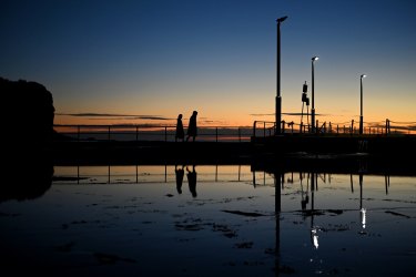
Dawn visitors to Mona Vale enjoy a fine end to winter and to kick off spring. Long-range forecasters suggest such days may not be so common later in the season.Credit:Nick Moir
Our Breaking News Alert will notify you of significant breaking news when it happens. Get it here.
Peter Hannam writes on environment issues for The Sydney Morning Herald and The Age.
Laura Chung is a crime reporter for The Sydney Morning Herald.